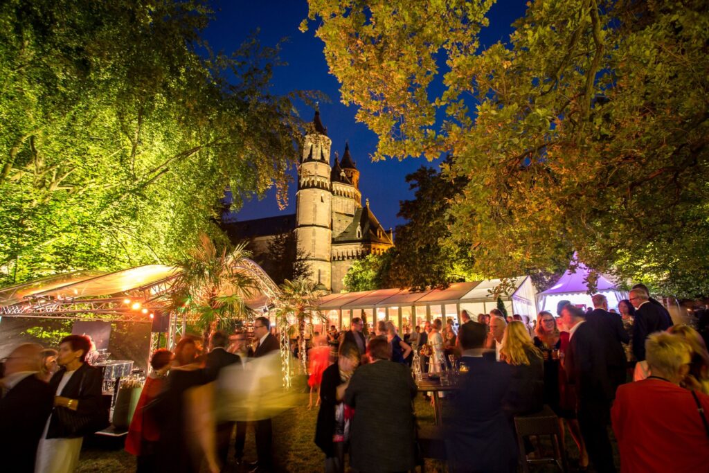
With its Hiwwelt tours and many themed trails, Rheinhessen has found a place in the hearts of many hikers. Hiking reveals the many facets of the region, and in the largest wine-growing region in particular, enjoyment and wine are a must. So that nobody has to "sacrifice" themselves as a driver and miss out on a sip of wine, I have picked out four hiking experiences in Rheinhessen for you, all of which are easily accessible by bus or train.
The hiking tours in Rheinhessen can be easily combined by car and from a parking lot with a stop for refreshments on the way or after the tour. However, many of the hiking tours can also be reached by bus or train and can be turned into a day of adventure. By train, the train lines between Bingen, Mainz and Worms are ideal. There are also rail routes across the country from Bingen to Worms or from Mainz via Alzey to Kirchheimbolanden in the Palatinate. Many bus lines complete the local public transport network.
Two of the hiking tours, near Stadecken-Elsheim and Mettenheim, are directly connected by bus or train. The access routes of the other two tours compensate for this with a high cultural and culinary value in the two towns of Ingelheim and Wörrstadt. For each tour, you will find examples of public transport connections and a description of the route. The frequency of the connections may vary depending on the day of the week and time of day (especially on Sundays). There are often other connections that involve changes or depart from other stations or stops.
For each tour, you will receive one or more tips on where to stop for a bite to eat. Pay attention to the current opening times of the restaurants, as these can vary greatly depending on the season. All hiking tours are very well signposted and each tour is available online as a map and as a GPX file to download for your hiking app.
Rheinterrassenweg Mettenheim - Guntersblum
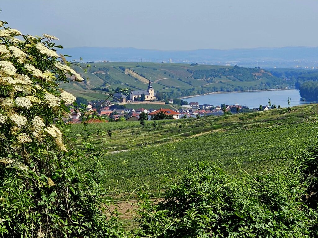
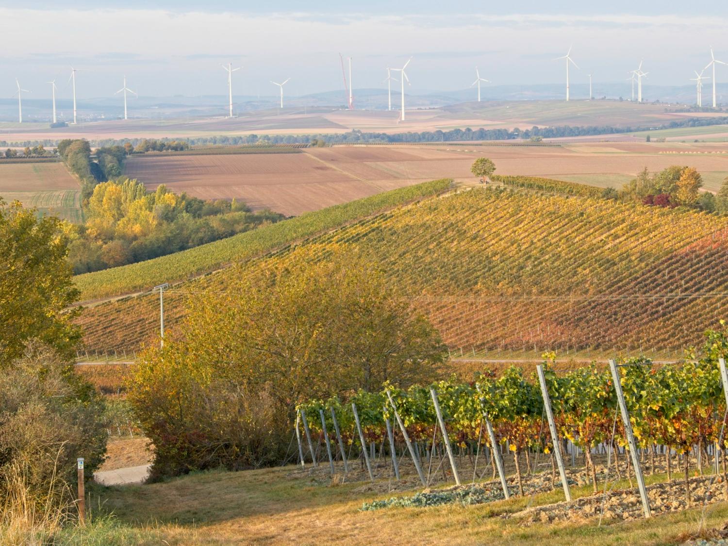
The Rhine Terrace Path connects the two cathedral cities of Worms and Mainz in six regular stages over around 75 kilometers and runs parallel to and above the Rhine through vineyards and hillsides. The stages can be freely arranged, extended or shortened, as almost all towns along the stages have a train station.
After a short ascent, the Rheinterrassenweg can be reached everywhere and the respective train station after a descent. The S-Bahn line 6 runs regularly every 30 minutes or so between Mainz and Worms. As an example, I present stage 3 from Mettenheim via Alsheim to Guntersblum. It is possible to stop for a bite to eat with a detour in Alsheim and then in Guntersblum.
- Stage tour
- Length: 10.5 km (without explorations in Alsheim)
- Duration: 3:15 h (without breaks, stops or explorations in Alsheim)
- Altitude difference: 167 m uphill, 175 m downhill
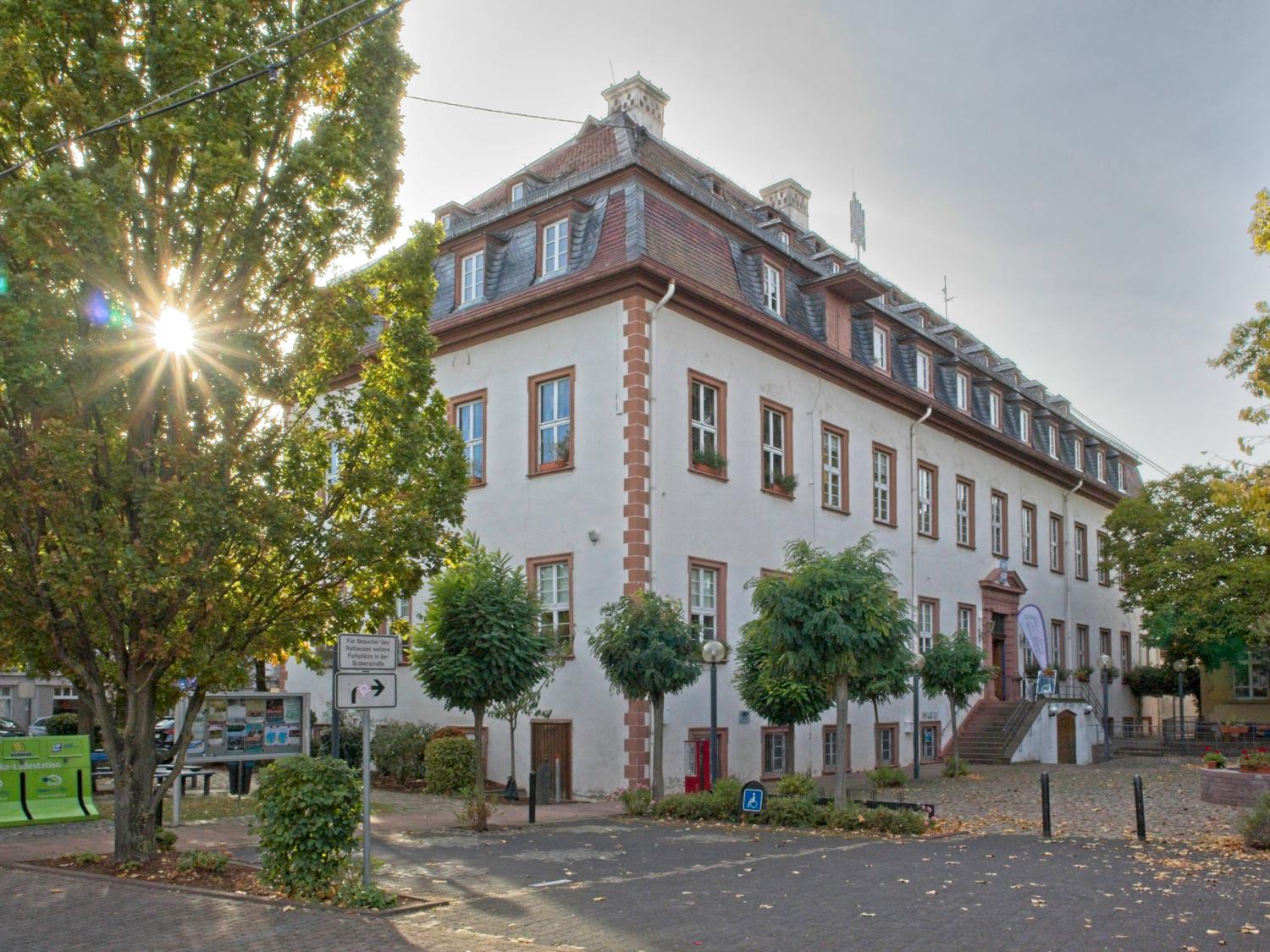
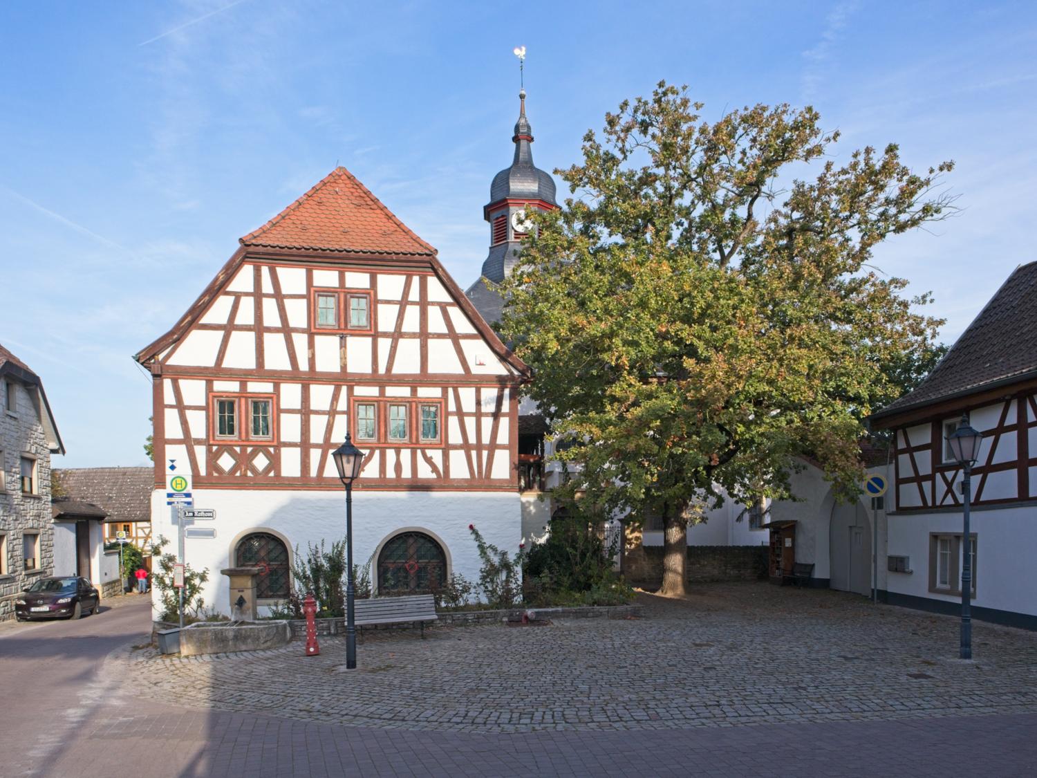
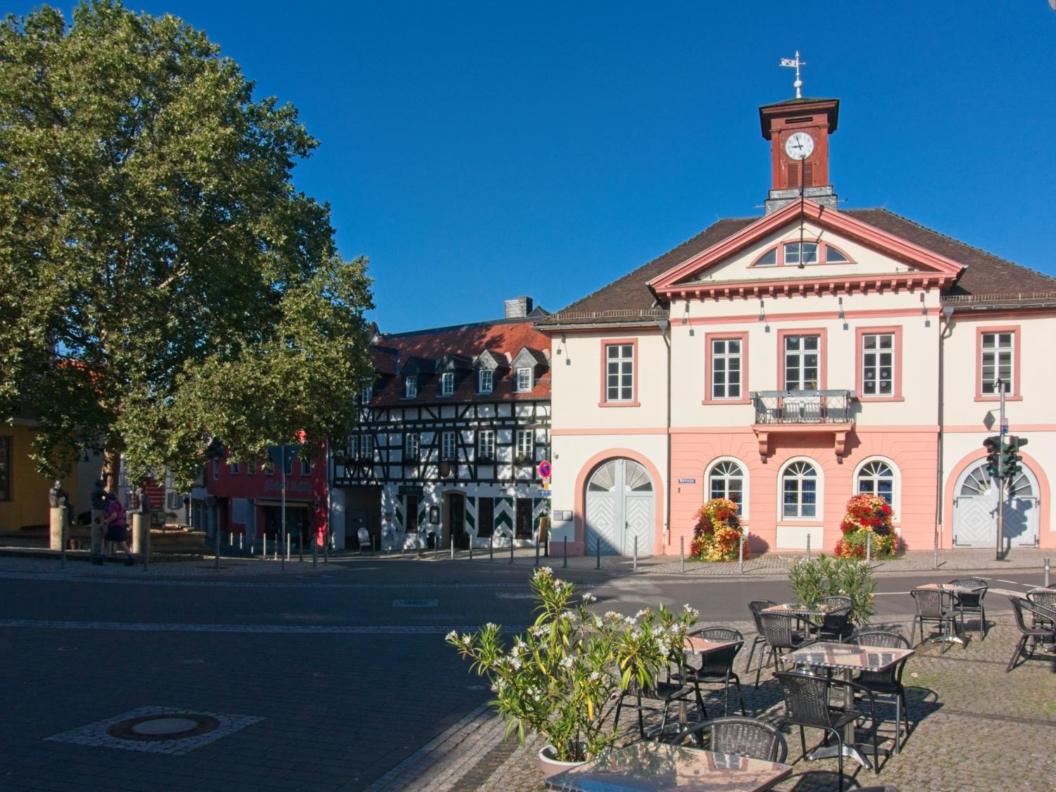
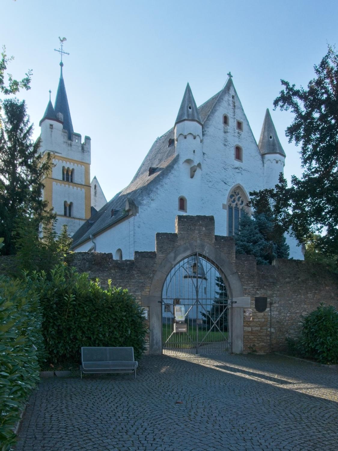
The tour starts at Mettenheim railroad station, where the historic town hall and the Protestant parish church are particularly worth seeing. After the main road and Rohrbrunnenstraße, the route quickly climbs up to the Rheinterrassen, where you will see vineyard cottages along the way, inviting you to stop for a snack with your own provisions. Near Alsheim, you should make a detour to the "Heidenturmkirche" church of St. Boniface (Mühlstraße 31). The cemetery behind it is also worth a pause.
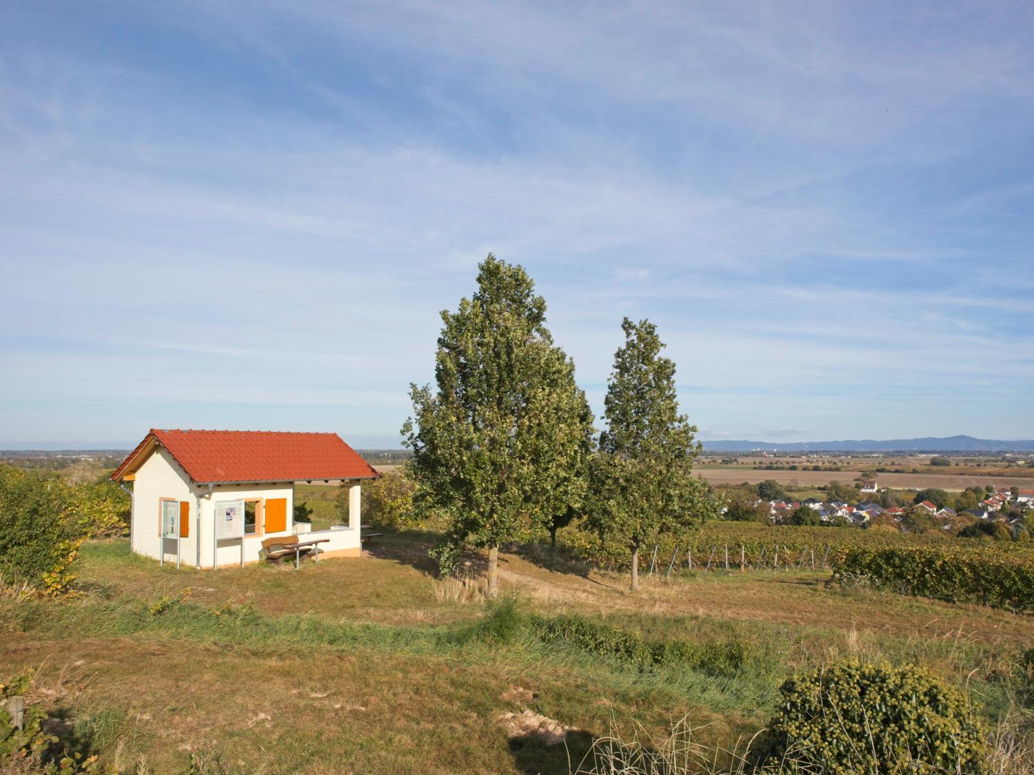
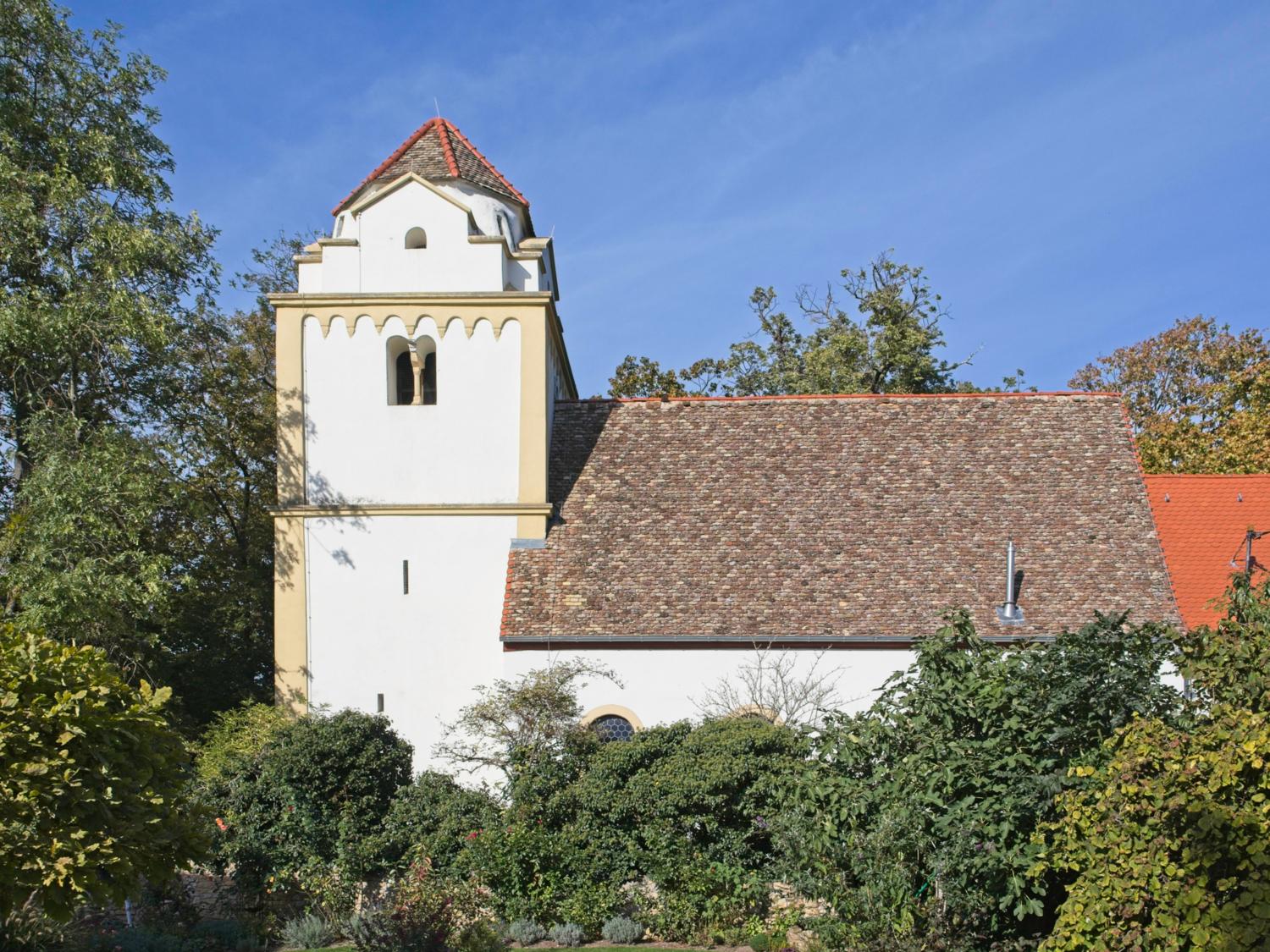
In total Four Rhine-Hessian "heathen tower churches" can be found in Rheinhessen: In Alsheim, Guntersblum, Dittelsheim-Heßloch and Worms. They were built after the First Crusade around the year 1100, and it is likely that returnees brought with them their memories of the oriental architectural style for the towers. Extensive examinations of the wooden beams of individual towers have confirmed their age. Not far from St. Boniface's Church is the old wine press house (Außerhalb 7), whose idyllic ambience invites you to take a break.
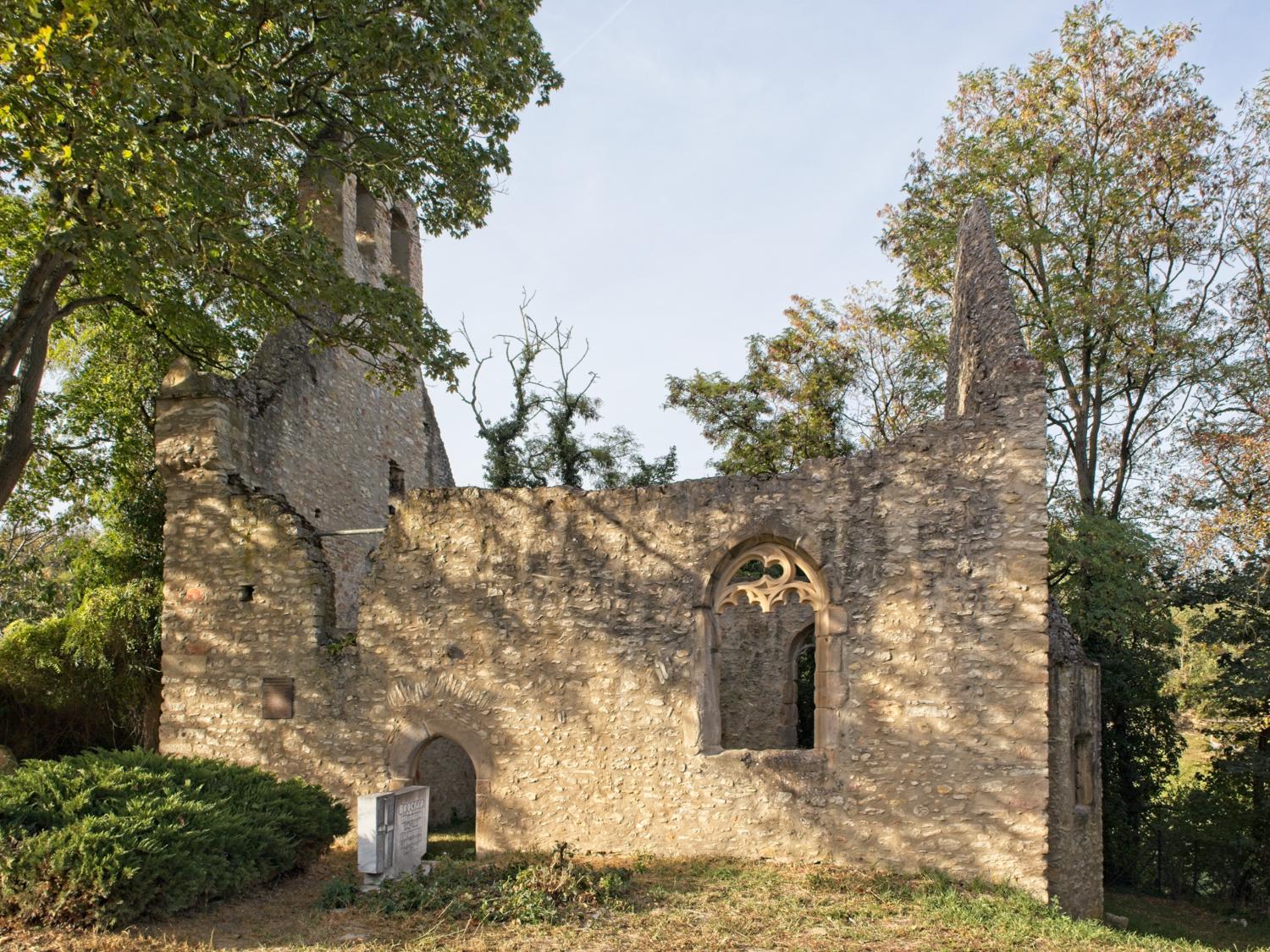
There are several hollow paths around Alsheim, which have deepened over the centuries due to erosion and wagons and are now home to unusual plants and animals such as the chimney wasp and the ant lion. Between Alsheim and Guntersblum, in the small Alsheim district of Hangen-Wahlheim, lies the late Gothic church of Maria Magdalena and Jakobus, which has been in ruins for centuries. Until a few years ago, the deceased were still buried here. A private association has restored the church ruins.
Guntersblum is home to another of the four pagan tower churches, the "Sarazenenkirche" (Kirchstraße 3). It is open daily from 10 a.m. to 6 p.m. as an "Open Church" of the Protestant Church of Hesse-Nassau. Not far from here is Leiningen Castle, which was built at the beginning of the 18th century as the residence of the Leiningen noble family. After many changes of ownership, the castle now serves as the town hall for the village and as an administrative office for the Rhein-Selz municipality.
Not far from Leiningen Castle you can stop for a bite to eat at the Café Mai (Promenade 22). On the main street there is the "Schinderhannes Weinstall" wine tavern in the Karl-Heinz Frey Winery (Hauptstraße 81) and the Restaurant Weingold (Hauptstraße 33) from Domhof Winery.
Tour map with description and GPX download: RheinTerrassenWeg stage Mettenheim - Alsheim - Guntersblum.
Hiwweltour Neuborn, Wörrstadt
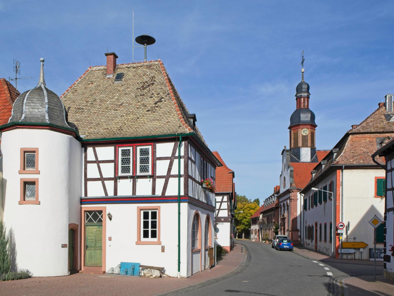
The Hiwweltour Neuborn near Wörrstadt is one of the shorter Hiwweltours. It is located in the middle of Rheinhessen, offers many views and leads through both the vineyards and the picturesque district of Rommersheim. Wörrstadt itself is a small town typical of Rheinhessen with historical sights and plenty of places to stop for refreshments.
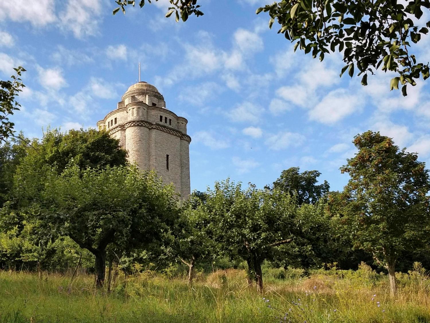
Wörrstadt station is served by regional trains and regional express trains from Mainz every 30 minutes or so. From Bingen (city), you can reach Wörrstadt by regional train every hour with a change in Armsheim. From the station, a path leads through Wörrstadt and to the Hiwweltour. The quickest way to reach the Hiwweltour is via Friedrich-Ebert-Straße and Rommersheimer Straße in 1.5 kilometers, then enter the Hiwweltour at the bend and within sight of the Burgundy Tower. It is possible to stop for refreshments on the tour and afterwards in Wörrstadt.
- Round trip
- Length: 8 km (without access route through Wörrstadt)
- Duration: 2:15 h (without breaks, stops or access route through Wörrstadt)
- Altitude difference: 81 m uphill, 81 m downhill
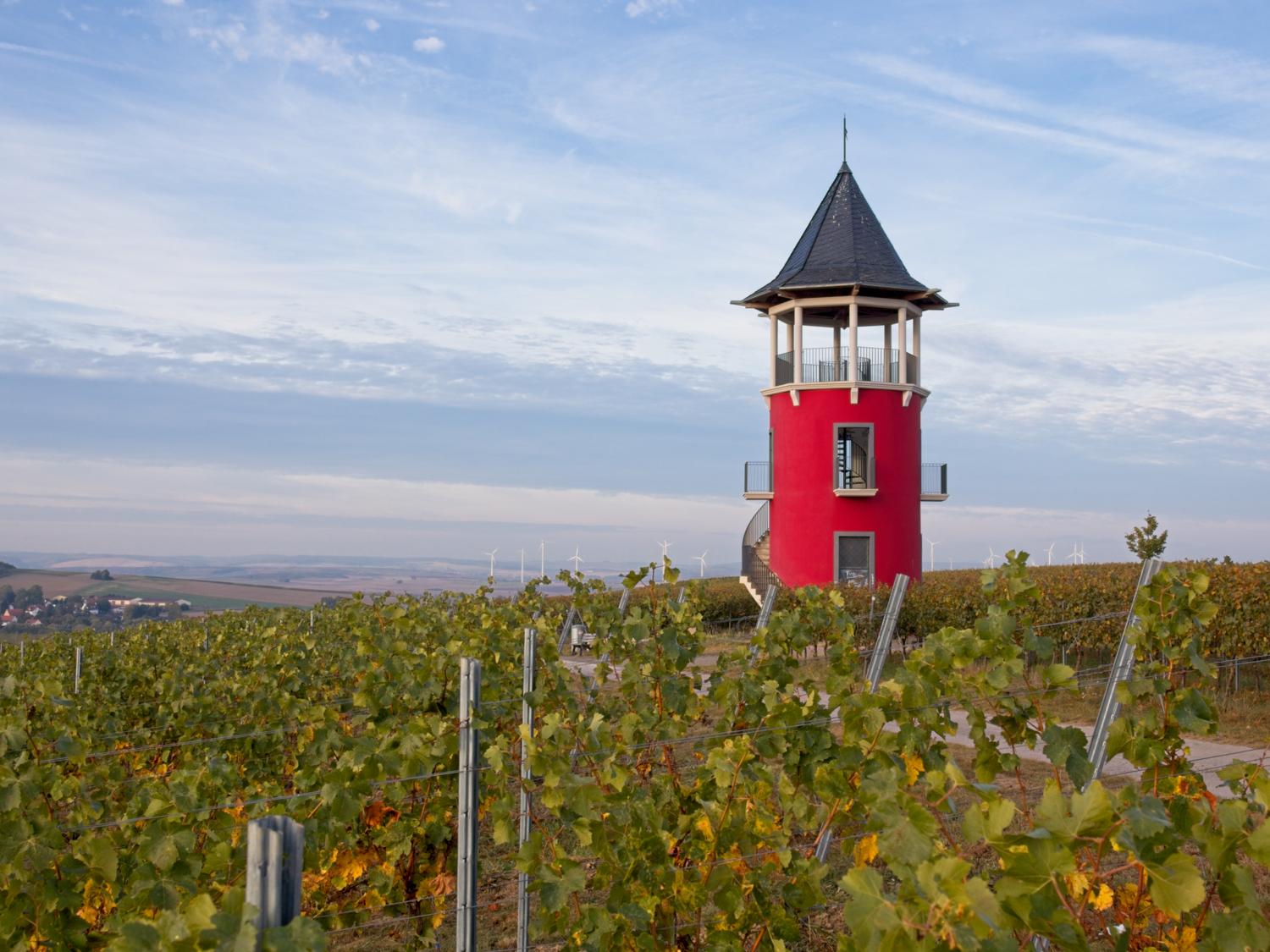
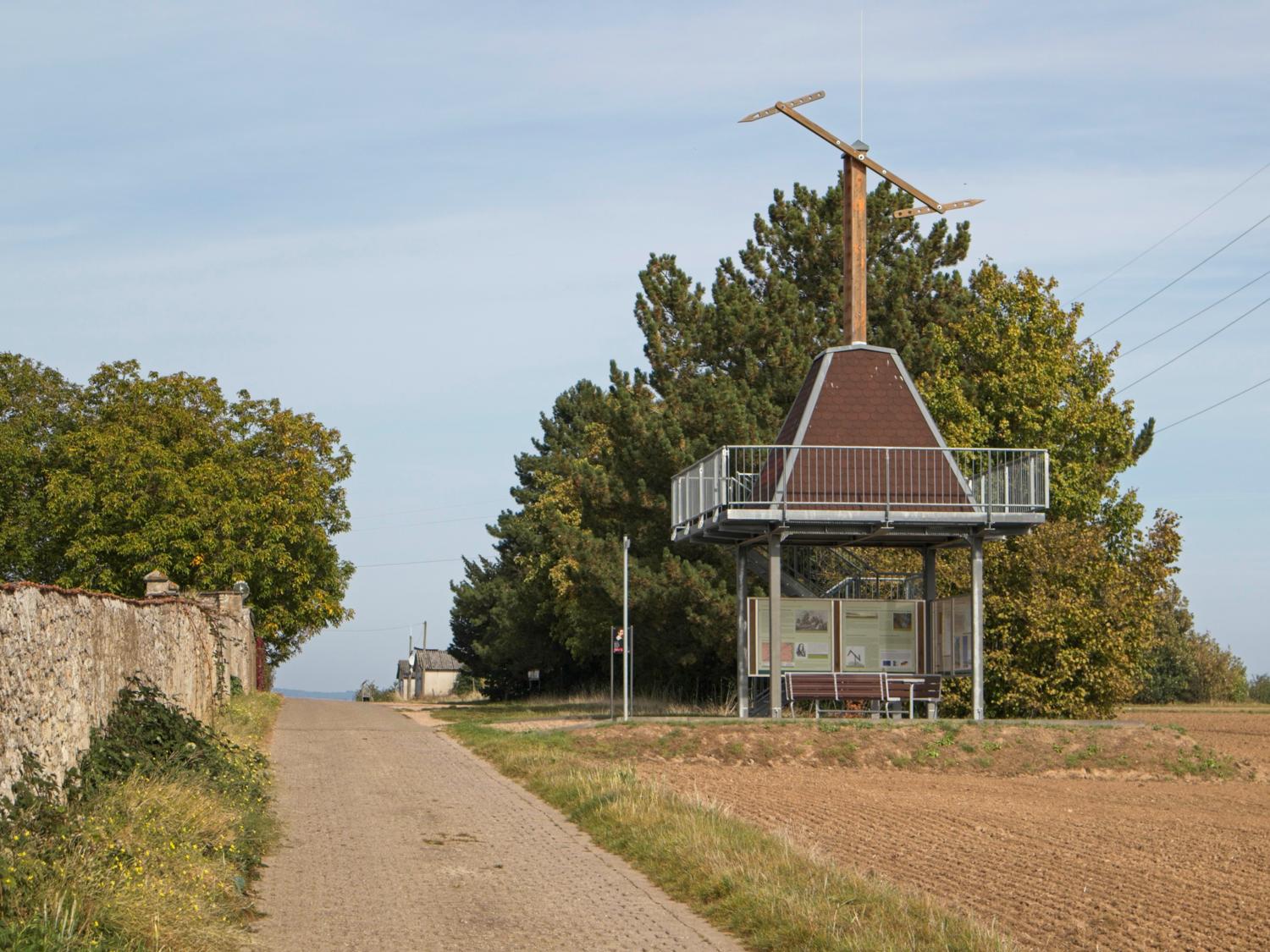
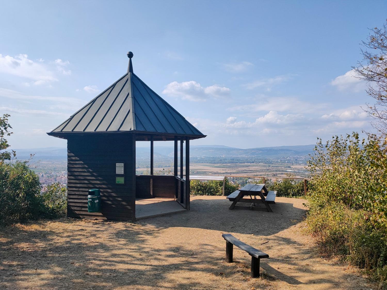
There is an ice cream parlor and other places to stop for refreshments around Röhrenplatz. The square takes its name from the large tube well that used to supply Wörrstadt with water. In order to avoid the inconvenience and expense of fetching water from wells in the surrounding area, wooden pipes were laid in many communities to carry water to a well in the town center. The Wörrstadt tube well is a particularly beautiful example. The Hiwweltour offers several views, such as from the accessible Burgundy Tower, which was given its color in honor of the partner region Burgundy. Another stop on the tour, the Greifenberg, can be seen from a small roofed hut at the "Schöne Aussicht". Three Roman sarcophagi were found on it.
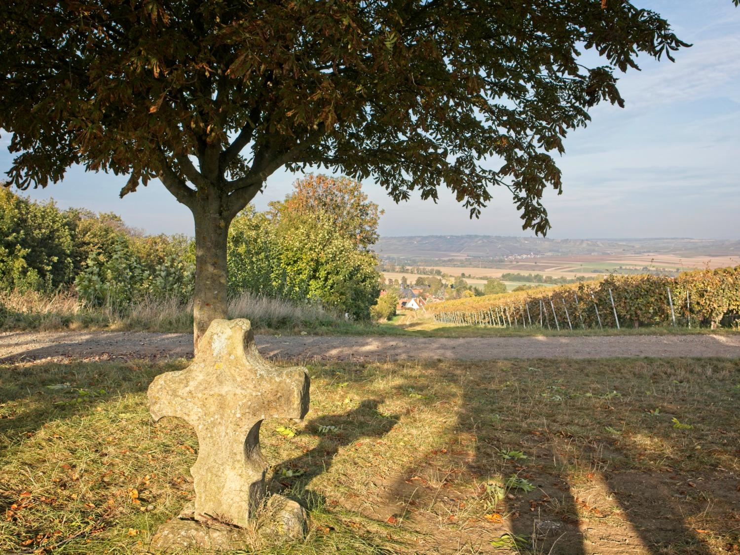
At the stone cross on the hill, you can look back over Rommersheim to the Greifenberg. The village was not given its current name until 1931, until then it was called "Eichloch". It is said that the inhabitants wanted a new name because the old name colloquially began with "A" and sounded like a nasty swearword.
In the forest and at the Neuborn spring lies the rustic Forest restaurant Neuborn (Neuborn 1), where shady spots invite you to linger. In Wörrstadt, the way back to the train station is not far away. Böhm's wine vault (Schlagstr. 2-4). The wine vault is more recent, but its architectural style is reminiscent of the famous "cow chapels" of Rheinhessen. In the 19th century, several hundred stone cowsheds with cross vaults were built. The stone material was used to reduce the frequency of barn fires and to bridge larger areas with ceilings. Because of their sacred appearance, the people of Rheinhessen called these cowsheds "cow chapels".
Tour map with description and GPX download: Hiwweltour Neuborn.
Adam Elsheimer circular route, Stadecken-Elsheim
The Adam Elsheimer circular trail is a local themed trail that presents the life's work of the Baroque painter Adam Elsheimer from Elsheim at several stations. Created by the Adam Elsheimer Initiative, the tour leads from the village square in the district of Elsheim from the valley with two ascents to panoramic heights before returning to the village square.
You can get directly to the village square from Ingelheim train station every quarter to half an hour in about 20 minutes with bus route 640, from Mainz or Sprendlingen every quarter of an hour or hour in about 25 minutes with bus route 630. After the tour, you can stop for a bite to eat in Elsheim and with a bus stop in Schwabenheim an der Selz.
- Round trip
- Length: 5.8 km
- Duration: 1:37 h (without breaks or stops)
- Elevation gain: 137 m uphill, 137 m downhill
The Adam Elsheimer Initiative is a group of citizens from Stadecken-Elsheim and Rheinhessen who set themselves the task in 2009 of preserving the memory of the life and work of the almost forgotten German Baroque painter Adam Elsheimer and anchoring it in people's hearts and minds. Adam Elsheimer is regarded today as one of the most important and influential painters of the Baroque period. With his art, he has carried the name of Elsheim and today's local community into many countries and into the world's most famous museums.
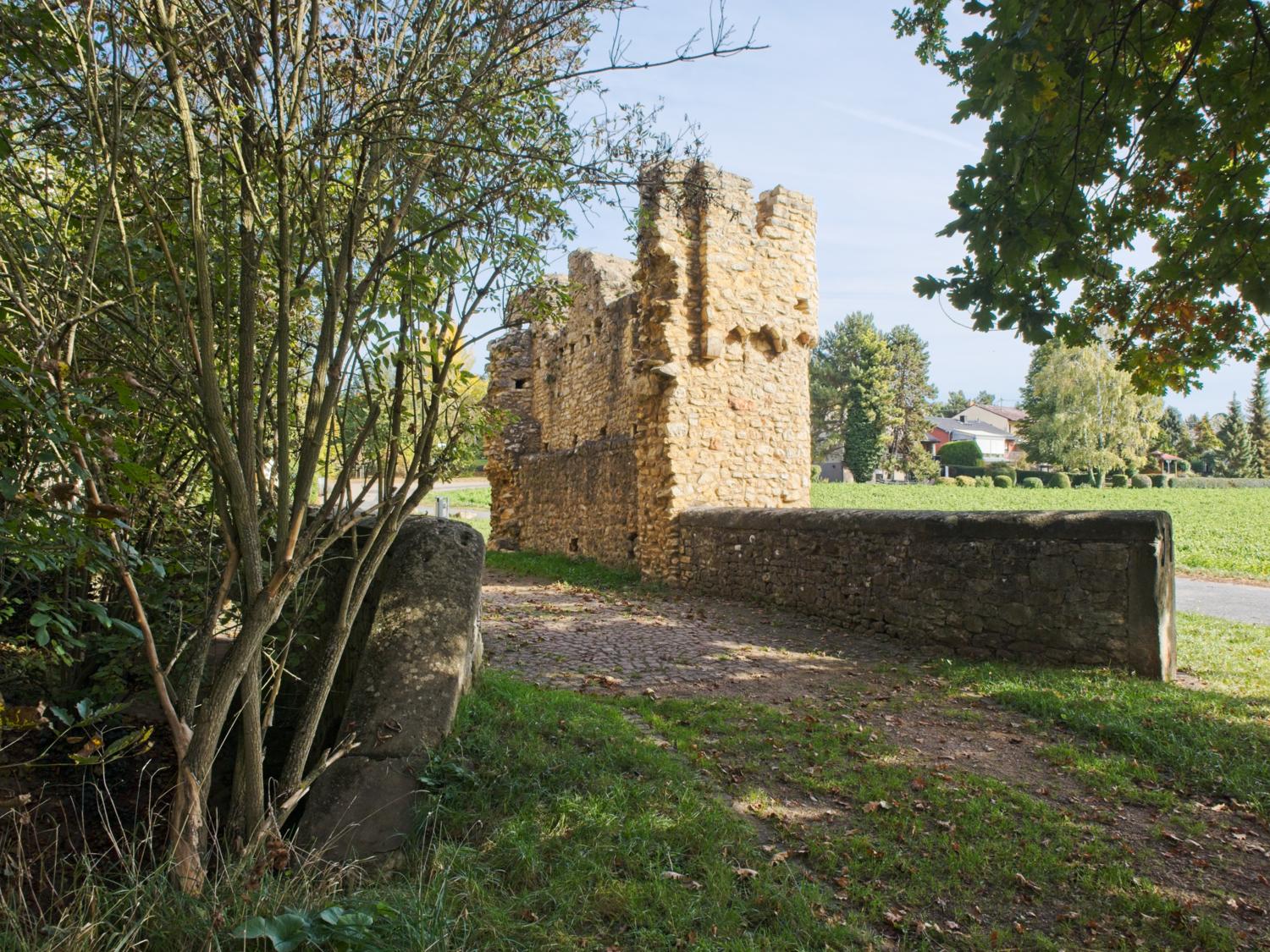
The Adam Elsheimer circular trail is an approx. 6 km long hiking route around the district of Elsheim, showing selected works by the artist Adam Elsheimer along the way. The well-maintained paths lead through various vineyards and past beautiful vantage points. Selected works by the artist Adam Elsheimer are shown and explained along the way. This is a wonderful way to combine art, nature and history on an eventful hike. At the beginning, a short detour leads to the Eleven Thousand Maidens Tower. Saint Ursula of Cologne is said to have crossed the Selz at this customs tower, which was built around the year 1000, accompanied by 11,000 virgins on her pilgrimage.
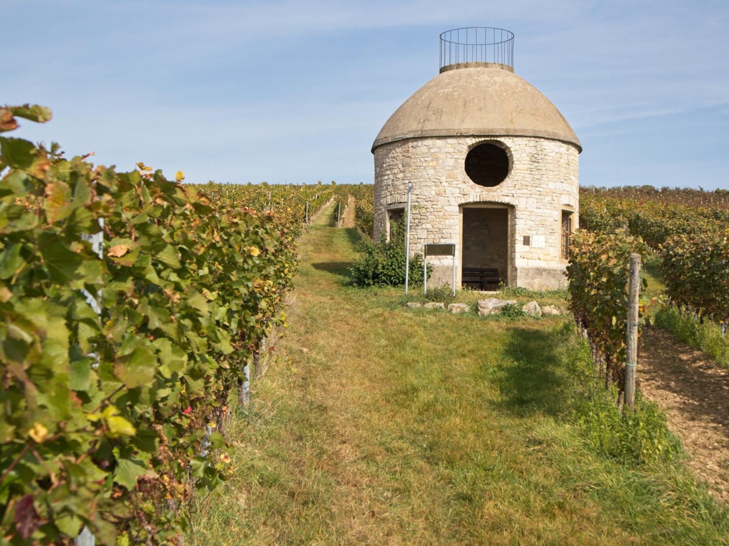
After the ascent with a stopover at the Babo cottage, the replica of the French telegraph station "Heidenhof" sits enthroned at the top. When Rheinhessen was French for a few years at the beginning of the 19th century, a line of optical telegraph stations was built between Mainz and Metz.
After crossing the road, the route leads down past a wine table, up to the Hieberg tower and then loops back to Elsheim.
After the hike, it is only about 300 meters to the Mengel-Eppelmann Estate Tavern (Mühlstraße 16). Alternatively, you can make a stopover in Schwabenheim on your return journey by bus to Ingelheim and stop off at one of the restaurants there, such as the Landgasthof Engel (market square 8).
Tour map with description and GPX download: Adam Elsheimer circular route.
Hiwweltour Bismarck Tower, Ingelheim am Rhein
This Hiwweltour starts at the Bismarck Tower above the town of Ingelheim and leads through vineyards, through a nature reserve and past the small town of Gau-Algesheim. Ingelheim itself offers many places to stop for refreshments and sights.
The Ingelheim train station can be reached regularly from Mainz and Bingen in just a few minutes. From Ingelheim station, a path leads up to the Bismarck Tower over a distance of around 3 kilometers. It is worth taking a stroll through Ingelheim on Bahnhofstraße to Ober-Ingelheim with its market square and nearby castle church to reach the Bismarck Tower via Altgasse and Rheinhöhenweg as well as the access path. It is possible to stop for refreshments on the tour and afterwards in Ingelheim.
- Round trip
- Length: 10.3 km (without access route through Ingelheim)
- Duration: 3:00 h (without breaks, stops or access route through Ingelheim)
- Altitude difference: 151 m uphill, 151 m downhill
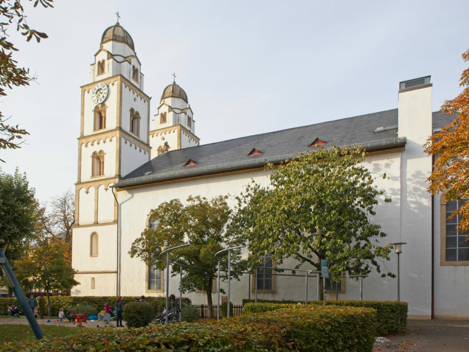
The town of Ingelheim was only created in 1947 by merging several villages, including Ober-Ingelheim with its picturesque market square. The castle church, surrounded by a defensive wall, is only around 200 meters away and provides an impressive setting for the Christmas market and the annual Ingelheim Red Wine Festival. After climbing the spacious staircase inside, the Bismarck Tower offers a sweeping view over the Rhine, the Rheingau and the Mainzer Höhe. The tower is open from 9:00-20:00 in summer and from 10:00-16:00 in winter. The Hiwweltour then continues with further views, such as from the GAGA hut (named after the Gebrothers Avenarius from Gau-Algesheim, who founded a chemical factory in 1869) to the outskirts of Gau-Algesheim and from there through the Welzbach valley to Appenheim. The restaurant is located directly on the tour Hundertgulden Mill (Mill 2), a short detour into the village leads to the Straußwirtschaft Eberle-Runkel (Niedergasse 25).
Through the famous Appenheimer Hundertgulden vineyard, the route leads back up to the wooded heights, where the barren remains of an artillery position bear witness to the Selzstellung, which formed a protective ring around the fortress city of Mainz with around 350 fortifications before the start of the First World War. At the end of the Hiwweltour, Brauser's Bergschänke (Waldeck 3) and, right next to the Bismarck Tower, the Waldeck mountain restaurant (Waldeck 1). Attached to the mountain restaurant is the Tiger Garden Waldeck with Bengal tigers.
On the way back through Ingelheim, you can stop off at the Restaurant Wasems Engelthal Monastery (Edelgasse 15) and the Manor pub "Zum Kuhstall" of the Bettenheimer winery (Stiegelgasse 32). Both refreshment stops are located in the historic cross vault of a "cow chapel".
Tour map with description and GPX download: Hiwweltour Bismarck Tower.